 Posted by
Position: 59°41’48.7″N 135°14’17.9″W

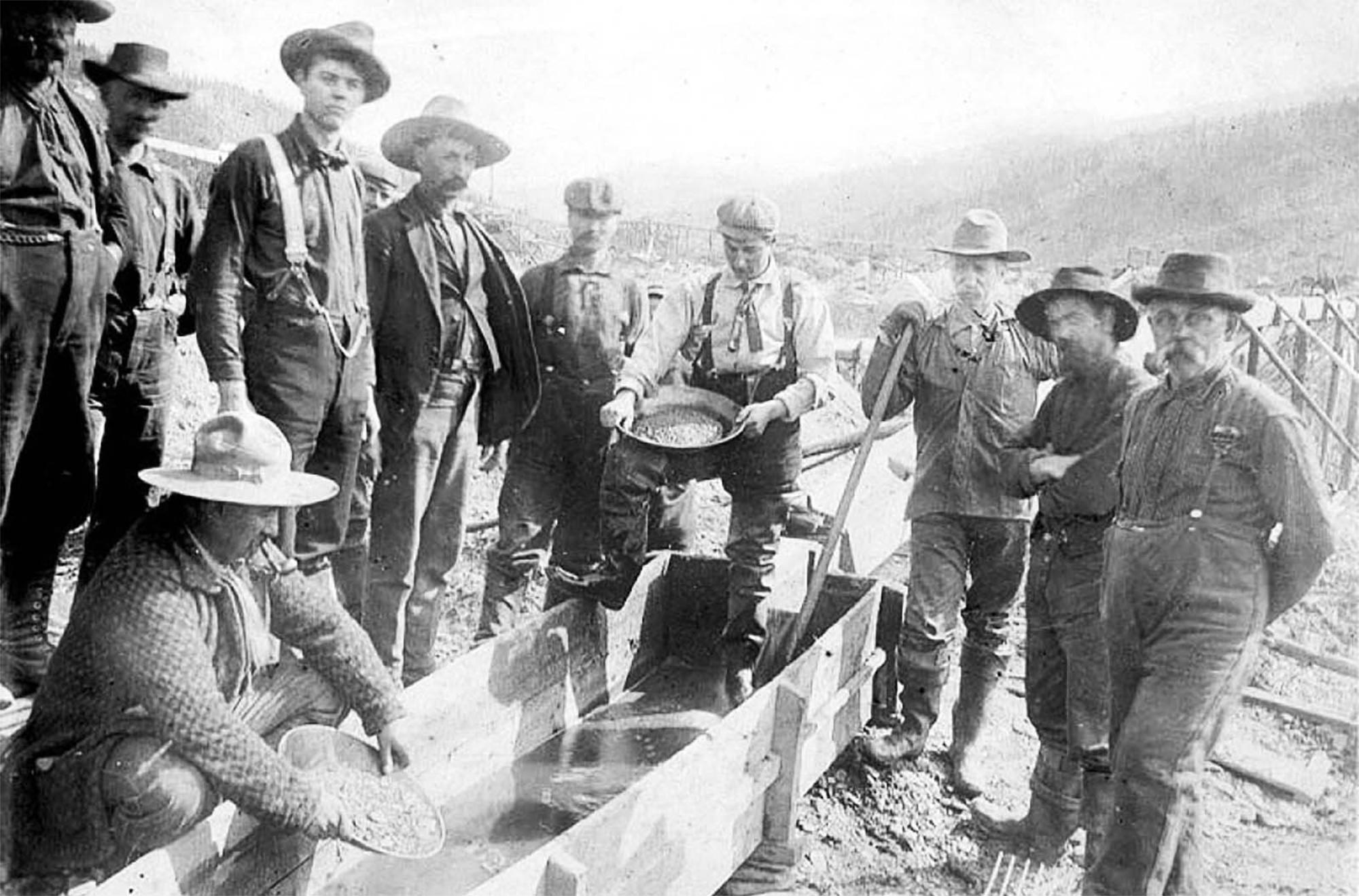
The ferry from Haines passes along the well worn Chilkoot Channel. For the past 130 years ships have plied this body of water bringing optimists and adventurers from the lower 48 to the Gold Rush ports of Dyea and shortly afterwards, Skagway. In August 1896 a Tlingit man, Keish, aka “Skookum Jim”, and his family discovered gold on Rabbit (later Bonanza) Creek, near the Klondike River, in Canada’s Yukon Territory. About a year later word of the discovery reached San Francisco and Seattle creating a ‘stampede of prospectors’. Over 100,000 “stampeders” (as they became known) pitched up from far and wide. Everyone from doctors to cricketers wanted to make their fortune in the gold fields.
Hell and Damnation

Most arrived at the port of Dyea or Skagway, the former choosing the Chilkoot Pass, the latter the White Pass. According to a National Park Service documentary, the Chilkoot Pass was “Hell” and the White Pass “Damnation”. To prevent starvation (and no doubt discourage people), the Canadian government insisted that each person bring with them enough food and supplies to survive a year. That translated to about a ton of goods that needed hauling through the mountains. Stampeders spent $1,000 on average preparing and travelling to the Yukon. That’s about $40,000 in today’s money. Small wonder, then, that so few made their fortunes panning for gold. On the bright side, it’s not as big a financial hole as a college education in America is these days.
Those with means hired local porters to help them carry their equipment through the passes. Those who couldn’t, made the arduous climb time after time until they were done. White Pass was particularly hard on pack animals and over 3,000 horses died along the trail. Their bones are still visible in Dead Horse Gulch. Even at the top of the passes, the stampeders still had another 550 miles to trek before reaching the Yukon’s gold fields.
Avalanche

In 1897 Dyea was a town of some 1,500 souls all engaged in the business of outfitting, or entertaining, stampeders and getting them up over Chilkoot Pass, climbing the ‘golden staircase’. So named because in winter steps were carved into the snow. On Palm Sunday, April 3, 1898, a series of deadly avalanches and snow slides occurred between Sheep Camp and Scales on the Chilkoot Trail. A series of heavy snowfalls and warming cycles had destabilised the snowpack. The risks were well known to veteran Alaskans and local Tlingit guides alike.
Nevertheless, stampeders ignored the warnings and kept climbing through the heavy spring snowstorm. The avalanches roared down the valley trapping hundreds. Word and warning gun shots of the disaster made their way down the valley. 1,500 stampeders dropped everything to help dig out the victims. Many were pulled from the snow only to die later from exposure and cold. Nevertheless, news of the disaster was widely reported with varying accounts of how many died. In all probably 65 people were killed. Thanks to poor record keeping and identification an exact count of who and how many will never be known.
Railway

The scale of the disaster and the vivid descriptions of the avalanches were enough to quell interest in the Gold Rush. Over the next couple of years, the population of Dyea dwindled rapidly, egged on by the construction in 1898 of the White Pass railway which terminated in Skagway. Today, Dyea is home only to a Skagway City campground with some of the most spectacular views you could hope for. There are a few streets preserved only by gravel paths through the woods as part of the Klondike Gold Rush National Historical Park. That plus a few informational signs, a faux cemetery, and some stubby pilings from a long-rotted dock are all that remain from what was once one of the busiest ports in the state.
Thanks to its deep waters, modern Skagway remains a busy port for cruise ships. The White Pass & Yukon Route railway still operates and if you hurry you might snag a reservation for a journey next year. Among the old railcars on display in Skagway is a massive rotary snowplough that kept the line open during the harsh winters. For decades the railway carried minerals and ore from the Yukon to the docks at Skagway. When metal prices crashed in 1982, the railway reinvented itself as a tourist attraction and today carries people as far as Carcross, YT, 65 miles away.
AMHS

The Alaska Marine Highway is a thing. Originally a ferry service founded in Haines by three local men and their ex-Navy landing craft, the Alaska Marine Highway has expanded to 3,500 miles of routes. From Bellingham, WA, to Unalaska/Dutch Harbour in the Aleutians, the AMHS docks at 32 terminals and, because it is recognized as part of the National Highway System, it receives federal highway funding. It also has a designation as an All-American Road, meaning it is important both regionally and nationally and worthy of a visit all by itself.
Our ship, the MV Hubbard, invited Molly on board via a large opening on her starboard side. Her twin diesel engines thrummed into life, and we pulled away from the Haines Ferry Terminal with alacrity. The passage to Skagway took us through a deep fjord with hints of glaciers peeking out from the tall mountains above us. The day was clear and brilliantly sunny. CAVU as pilots would call it.

Pulling into Skagway past four huge ocean liners, a couple of which towered over us, the routine expertise of ferry dock-handlers came into play. Lightweight heaving lines got tossed to the shore crew. Those lines drew in heavy painters with huge eyelets destined for the bollards on the spidery docking terminal and were eventually woman-handled into place. Once secure and the boarding ramp lowered with a rusted, metallic groan, we made our way down to Molly and in short order found our way ashore.
N-N-N-N-19
Skagway’s main street was thick with tourists right off the ship. The local shopping wasn’t promising. Too many jewellery stores and tchotchke emporia for our liking. Fortunately, a sharp left turn towards the hills proved that tourists are essentially polyester sheep and the crowds quickly faded. Based on our earlier research, Dyea Flats Campground is only eleven miles from the ferry terminal, around a headland. For the uninitiated, there are two campgrounds near Dyea.

The first is a National Parks Service affair. We pulled in and decided that it was a little claustrophobic with tall overhanging trees and tight turns. Two miles further on, Dyea Flats is run by the City of Skagway. The gravel road drew us forward and with dust billowing behind us we took a turn around the campsite to scope out which sites were best. We lucked out. No one had taken 19. This campsite Is flat, open and afforded Panavision views up and down the valley. A few trees stood back from our tent and offered a modicum of privacy. It was, IOHO, the best site in the campground.
From number 19, we could see all the way up the Chilkoot Valley to the top of the pass. It’s only a 16-mile hike to British Columbia. Given the wide view of our surroundings, including down the calm waters of Taiya Inlet, this was our favourite campsite of the trip. The shallow Taiya River marsh with its long grasses and cattails lay at our feet, surprisingly free of biting bugs.


Sirens
Given the landslide on the White Pass highway, we opted for a couple of nights under canvas. At $10/night ($50 annually) we’d have stayed a month (if the limit weren’t 7 days). After setting up camp, a gin and tonic and a bite to eat, we were ready to turn in early. The following day we committed to braving the crowds in Skagway. In town we found the headquarters of the Klondike Goldrush National Park and spent an hour there edifying ourselves about the area’s relatively recent history.

My dad, being a gricer, passed on some of his passion for trains to me. Steam whistles are always evocative, and, like Odysseus’ sirens, few men can avoid their call. A steam engine chuffed in the marshalling yard and lent some verisimilitude to the modernised 19th century facades lining the main street. Down towards the docks I found the WP&YR’s gigantic snow blower with its useful information sign. The city was thick with beer bellies and over-stuffed spandex leggings from the cruise ships. With four ships at dock, we reckoned there were close to 10,000 tourists thronging the streets. In a good year, Skagway welcomes around 1.2 million passengers. That’s more Tommy Bahama and Lululemon than should be legally allowed anywhere – at any time!


Scale
After a quick turn through the local grocery, we headed back towards our campsite to wander Dyea’s ghostly historical outlines. A walk in the woods, really. But we got a sense of the town’s scale and its distance from the harbour. Images of original plat maps overlaid on the current topography take a bit of parsing. It looks like the river took a turn at some point in the past century and cut through the northeast corner of town. At least where it used to stand. Across the road is a memorial to the Palm Sunday avalanche. In a shady copse a few wooden grave markers are tacked together with names painted on them. It seems like more of an attraction than an actual graveyard. Back at camp we lit a fire and chatted about our trip. As the wood snapped and crackled the setting sun cast shadows on the tall mountains to the east. The unencumbered views made me want to stretch out my arms and gather in our surroundings as a happy keepsake.
BC – YT

The following morning, we pointed Molly up the White Pass towards the Canadian Border. Early reports from Google Maps said the road was closed for weeks. 511 Yukon said it was open from 09:00 to 17:00 as crews worked on clearing the landslide. Completely biased and brimming with self-interest, we chose to go with local information. At the border, the Canadian agent quizzed us on what weapons we had to protect ourselves while camping? Bear spray, not guns, we confirmed. Had we camped before, the agent asked? Pointing a thumb at the back seat stuffed with gear, we chose not to use the soubriquet ‘no-shit-Sherlock’ in our answers.
Twenty minutes later we were on our way. In another ten minutes we found the landslide and quickly skirted it. It couldn’t have been more than 100 yards wide, and a safe path had been cleared. It wasn’t as though half a mountainside had fallen onto the road or anything. We kind of wondered what all the fuss had been about. But the internet has a way of catastrophising that is even more effective than little old ladies.
Pratlin’ about Atlin

Our host in Haines, Dylan, had recommended we visit Atlin in British Columbia. A small holiday town on Atlin Lake that promotes itself as the Switzerland of BC. While very pretty with a nifty (dry-docked) wooden passenger boat, I had a hard time seeing Switzerland in the low-ish surrounding hills. Perhaps at the right time of year you could conjure up Lac Lausanne. Still, it turned out to be a worthwhile detour as Carol found a wonderful curiosity shop, the Magpie, that yielded a unique and prettily-designed pendant to go with her Haines distillery earrings. Looking out from the deck of Kershaws Café over an excellent coffee, I got a strong hankering to sail a small boat across the lake. The café’s French-Canadian owner had the sultriness that one hopes for from Gallic women. Her son is, for all his teenaged awkwardness, apparently destined for greater things.


In the morning, I checked out the excursion boat Tarahne. The Tarahne has an interesting history, not least because she was extended by 41 feet 11 years after she was launched. Tourism in Atlin during the 1920s drove demand for an excursion vessel. The British Yukon Navigation Company, a branch of the White Pass & Yukon Route railway, was happy to provide. Tourism crashed with the stock market in 1929, and the Tarahne was eventually beached in June 1958. She remains a curiosity on the lakeside to this day. For a few days a year you can explore the ship, but mostly she’s a photo opportunity.
Smoke and Fire!
For our part, we were heading home and debating on how bad the air quality in southern BC and Alberta was. With several large forest fires raging in the area, things didn’t look good. But before that we had planned a hot springs soak in the Northern Rockies. That’s next…


